
Whidbey Island and Skagit
Lost a ring on Whidbey Island?
From the tide flats at Double Bluff to the tulip fields of the Skagit Valley, the ground changes every few miles.
A ring dropped into soft sand feels gone, and it usually is not. On the sand near the Double Bluff access a band sits in the top 15 to 25 cm (6 to 10 inches) and stays there for days rather than sinking away. On the stony stretches it drops between cobbles, where a detector still hears it but recovery takes longer. What decides the whole thing is whether you can point to the spot within a few metres.
Ring Seekers is a lost ring and jewelry recovery service that works with experienced local metal detectorists to search for a ring, wedding band, watch or phone lost on Whidbey Island, in Anacortes or in Mount Vernon. There is no local shopfront, but there is a plan for every search. Tell us what happened and where. We choose an experienced detectorist who knows the beach, brief them with your map and photos, and tell you honestly if the odds are poor.
Mark it with driftwood, and write down the hour
In the first hour, do not dig with your hands, as that pushes a ring deeper. Mark the spot with driftwood above the waterline or a stick in the grass, take a photo looking each way, and save the tide table for the day. At Coupeville the water rises about 11 feet (3.4 metres) on an ordinary day, so where you stood at noon may be under 2 metres of water by evening.
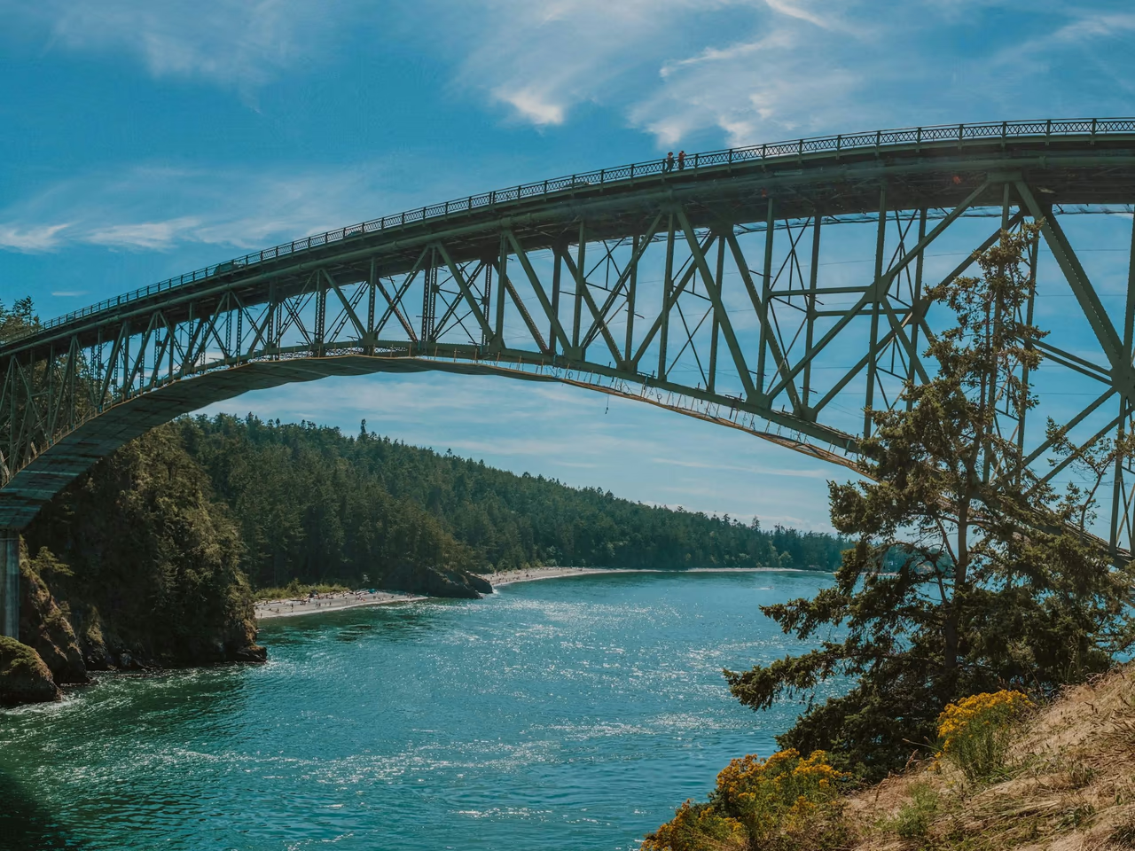
Then send the pin, the photos, the hour and what was lost. We work out whether a searcher comes over the Deception Pass bridge or on the Mukilteo ferry, and which tide to aim for.
Places we cover in Whidbey Island and Skagit
- Whidbey Island
- Clinton and the Mukilteo ferry landing
- Langley waterfront on Saratoga Passage
- Double Bluff Beach on Useless Bay
- South Whidbey State Park
- Coupeville waterfront on Penn Cove
- Beach by Admiralty Head Lighthouse, Fort Casey
- Fort Ebey shoreline on the Strait
- Oak Harbor bay shore
- West Beach and North Beach, Deception Pass State Park
- Cranberry Lake, Deception Pass
- Bowman Bay and Rosario Beach on Fidalgo Island
- Anacortes
- Washington Park and Sunset Beach, Anacortes
- Mount Vernon
- Edgewater Park on the Skagit River
- Skagit Riverwalk Park, downtown Mount Vernon
- Little Mountain Park, Mount Vernon
- Skagit Valley tulip fields
From the Useless Bay flats to the tulip rows
Whidbey Island is about 37 miles (60 km) long, and the Skagit shore and valley add river parks and farmland. Which of them you were on shapes the whole search.
Double Bluff Beach, Useless Bay
About two miles of public beach under bluffs up to 300 feet (90 metres) high, sandy at the access and stony further along. Useless Bay shelves so gently that the high and low tide lines can be more than 2,500 feet (760 metres) apart. Rings and Oura rings come off while throwing balls for dogs and wading out on the flats, and the soft sand at the access end holds them near the surface.
West Beach and North Beach, Deception Pass
Washington's most visited state park, with about 15 miles (24 km) of shoreline and, at West Beach, the only sizeable sand dunes on Puget Sound. Rings slip off cold hands in the shallows and during photographs on the rocks by the bridge, and the bridge is the one landmark everybody can point to from a photo.
Fort Ebey and Fort Casey beaches
Fort Ebey State Park has 3 miles (4.8 km) of shoreline on the Strait of Juan de Fuca under high bluffs, where the wind takes hats and sunglasses off the headland. Fort Casey has a rocky beach beside Admiralty Head Lighthouse, built in 1903, and the lighthouse is an easy line to measure from.
Washington Park, Anacortes
A city park of 220 acres on a peninsula at the west end of Fidalgo Island, with a 2.2 mile paved loop road and picnic shelters near Sunset Beach. Lawn, shelter and rocky shore sit a few steps from each other, so saying which of the three you were on saves a searcher an afternoon.
Edgewater Park and the Riverwalk, Mount Vernon
Edgewater Park covers 54 acres of West Mount Vernon along the Skagit River, with softball and soccer fields, picnic grass and a boat launch. Earrings and rings dropped on mown grass are good targets, because the thatch holds them near the surface instead of letting them sink.
Skagit Valley tulip fields
The Skagit Valley Tulip Festival usually runs through April, with display gardens and fields around Mount Vernon. These are working farms and the festival warns that the paths are often deep mud, which is why so much comes off here and also why what comes off tends to stay put.
Langley, Coupeville and Oak Harbor
Town waterfronts on Saratoga Passage, Penn Cove and Oak Harbor bay, with shops and docks at the top of the beach. These are short, easily described stretches, so a photo with a building or a dock in it puts a searcher within a few metres.
What you get from Ring Seekers here
One person on WhatsApp
You message us, we take the details and agree terms, and the same person stays with you until the search is done.
The detectorist starts with your map and photos
Whoever goes to Double Bluff, Washington Park or Edgewater Park gets your pin, your photos and the tide or time of day you lost it.
The tide picks the day, not the diary
A wet-sand search here happens at low water, so the hour comes from the tide table rather than from whenever somebody is free.
Plain words when the odds are poor
A ring dropped from the Deception Pass bridge or into the Skagit River is hard ground, and you hear that before anything is booked.
A figure before a ferry
What a search would come to is agreed while you are still deciding, not after somebody has crossed the water.
Cold water, big tides and soft ground
Puget Sound has little surf, but the tide moves a lot of water, and inland the ground is lawn, riverbank or farm mud.
Soft sand, cobble or mud
At the Double Bluff access and on West Beach a ring settles in the top 15 to 25 cm (6 to 10 inches) and stays there. On stony beaches each signal means lifting rocks by hand.
Tide range
Coupeville predictions for 2026 show about 11 feet (3.4 metres) on an ordinary day and more than 16 feet (5 metres) on the biggest late December tides. At Anacortes, 2026 predictions show about 8 feet (2.5 metres) between low and high on a typical day.
Cold water all year
Puget Sound averages about 45 F (7 C) in February and peaks near 53 F (12 C) in August and September. Anyone searching in the water wears a wetsuit or waders.
Grass, thatch and April mud
Inland the ground works in your favour. Mown grass at Edgewater Park or Washington Park holds a ring in the thatch near the surface, and the tulip field paths in April are mud that presses a small item in and keeps it there. Neither carries anything away, unlike sand under a moving tide.
Want a first idea of your chances? Try the lost ring recovery calculator.
Soft sand, stony shore, wet flats and tulip mud
My ring went into the sand at Double Bluff. How far down will it be?
Not far, which is the good news on that beach. In the soft sand near the access a band or an Oura ring settles into the top 15 to 25 cm (6 to 10 inches) and stays there for days rather than working steadily deeper. Further along it turns stony, and a ring that drops between cobbles still reads clearly but means lifting rocks by hand. Tell us which of the two you were standing on.
We were way out on the flats at Useless Bay when it came off. Is that hopeless?
No, but it is a timed job. Useless Bay shelves so gently that the high and low tide lines can be more than 2,500 feet (760 metres) apart, so the ground you were standing on only exists for part of the day. Give us the hour and roughly how far out you had walked, and a searcher can be put on the same sand at the same state of tide.
My wedding band slipped off in the shallows at West Beach, Deception Pass. What do you need?
The nearest fixed thing, and the hour. Deception Pass has about 15 miles (24 km) of shoreline and West Beach has the only sizeable sand dunes on Puget Sound, so a dune, the car park or the bridge itself gives a photograph something to measure from. Cold water shrinks fingers, which is why so many bands come off in those shallows and why a good number are found again close in.
I lost an earring in a tulip field near Mount Vernon during the festival. Is it gone for good?
Probably not. The Skagit Valley Tulip Festival usually runs through April, when the paths between the rows are deep mud, and mud is kinder than it looks: it holds a small thing right where it was pressed in instead of letting it travel. A detector still hears an earring under it. Tell us which farm, which display garden or row, and how far along you had walked.
Can you search Edgewater Park or the Skagit River bank in Mount Vernon?
Grass and riverbank, yes, and they are decent ground. Edgewater Park covers 54 acres of West Mount Vernon along the Skagit, with ball fields, picnic grass and a boat launch, and a ring dropped on mown grass tends to sit in the thatch near the surface. A watch that went into the river itself is a much harder job, and you would hear that from us before anyone went out.
I lost my ring on the shore at Washington Park in Anacortes. How quickly does that matter?
Quickly, because of the water. NOAA predictions for Anacortes in 2026 show about 8 feet (2.5 metres) between low and high on a typical day, so the rocks you were standing on can be covered within hours. Note the time before you leave, and say whether you were down at Sunset Beach, on the rocks or up by a picnic shelter.
What happens if the ring is not found?
You get told exactly what ground was covered, at what state of tide, and whether a second visit on a bigger low tide is worth doing. What a search would come to is agreed with you beforehand, so there is nothing to settle afterwards.
Whidbey Island and Skagit
Which ground was it, sand, stone, grass or mud
Double Bluff, Deception Pass, the Strait beaches, Anacortes, Mount Vernon and the tulip fields.
That one answer changes how a search is planned more than the name of the place does. Send it on WhatsApp with the hour, a map pin and a photo of the spot, and we can work out the tide and who can get there.