
South Padre Island
Lost a ring on South Padre Island?
From the jetty at Isla Blanca Park past the numbered city beach accesses to Andy Bowie Park, the Laguna Madre flats and Port Isabel.
Cold hands, a wet harness and a board going over: a ring comes off the Laguna Madre flats without anyone noticing until hours later. The bay helps here. The tide is tiny, the water is shallow and there is no surf to carry anything away, so what was lost sits close to where you were standing and the whole job is describing that spot.
Ring Seekers is a lost ring and jewelry recovery service that works with experienced local metal detectorists to search for a ring, wedding band, watch or phone lost on South Padre Island and in Port Isabel, on the Texas Gulf coast.
There is no local shopfront, but there is a plan for every search. Tell us what happened and where. We choose an experienced detectorist who knows the beach, brief them with your map and photos, and tell you honestly if the odds are poor. This page is for a lost ring or a wedding band, and just as much for an Oura ring, an earring, a bracelet, a watch, keys or a phone.
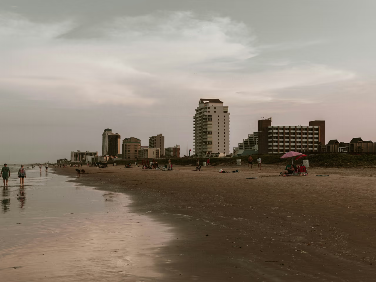
The first hour on the island or the flats
Fix the spot. On the Gulf side, note the beach access name and number, or the nearest park pavilion, and take a photo of the buildings or dunes behind you. On the bay side, use a walkway, a boat ramp or another fixed point. Drop a pin, note the time, then message us with a photo of the ring.
Then add what a searcher plans from. On the flats, how deep the water was and what the tide was doing, because that ground floods and drains daily. On the Gulf sand, how far you walked from the access and whether anyone has driven or dug over the patch since. If there is a park office or a lifeguard, ask there before you go, because jewelry is often handed in.
Places we cover in South Padre Island
- South Padre Island
- Isla Blanca Park and the jetty
- Dolphin Cove, Isla Blanca Park
- City beach accesses, Harbor Circle No. 1 to Whitesands Circle No. 25
- Pearl and La Copa beach accesses
- Andy Bowie Park (County Beach Access No. 2)
- County Beach Access No. 3 and No. 4
- Edwin King Atwood Park (County Beach Access No. 5)
- County Beach Access No. 6
- Laguna Madre bay side and bay ends
- Laguna Madre flats by Andy Bowie Park
- South Padre Island Birding and Nature Center
- Port Isabel
- Port Isabel Lighthouse and the Laguna Madre shore
Beaches and bay shores on South Padre Island where jewelry goes missing
Gulf surf, a tidal flat and a busy city beach sit close together here, and each changes what a search can do.
Isla Blanca Park, southern tip
Cameron County runs Isla Blanca at the south end of the island, where it meets Brazos Santiago Pass. The county describes over a mile of Gulf beach, a mile long jetty, a public boat launch and a bay beach to the south. Dolphin Cove, on the park peninsula, is used for fishing and kayak launches. A wedding band or watch can come off in the surf or while fishing from the jetty.
City of South Padre Island beaches
The city looks after 5 miles of beachfront and 170 acres of recreational beach, reached by numbered accesses named after the streets that lead to them, and many of those accesses carry rip current signs. Spring Break fills this sand, and a ring or an earring lost in a crowd is far easier to find if you marked the spot before moving.
Andy Bowie Park and the Laguna Madre flats
Andy Bowie Park sits at County Beach Access No. 2, 7300 State Park Road 100, just north of the city. Behind it on the bay side is a tidal flat that the county says is used year round for fishing and kite surfing and floods with the tide daily, so a ring lost there is under water for part of each day.
County beach accesses north of the city
North of Andy Bowie, Cameron County runs Beach Access No. 3, No. 4, No. 5 at Edwin King Atwood Park and No. 6. The county closed No. 4, No. 5 and No. 6 from 16 to 17 March 2026 because of high tides and undriveable conditions, so check before you drive up. Keys or a phone dropped beside a car show well on a detector.
Laguna Madre bay side
The west side of the island faces the Laguna Madre, with bay ends kept by the city. The bay tide is small, which helps a detectorist working the shallows for a ring or bracelet.
Port Isabel
Port Isabel sits at the mainland end of the Queen Isabella Causeway. The Port Isabel Lighthouse, built in 1852 and now a Texas Historical Commission site, overlooks the Laguna Madre and is visible from a long way off, which makes it the one landmark worth photographing yourself against on this shore.
What you get from Ring Seekers on South Padre Island
One person on WhatsApp
You explain it once. The same person takes the details, chooses an experienced detectorist who knows the island and keeps you posted.
Your map and photos go to the detectorist
The detectorist gets your pin, photos, beach access number and the time of the loss before arriving.
Plain about poor odds
A phone out in deeper water on the Laguna Madre, or a ring somewhere in the Gulf surf with no idea of the spot, is a poor bet. We say so before you spend anything.
Gulf sand and bay flats are two jobs
Open Gulf sand is swept in lines and the surf keeps working it over. The flats behind the island are shallow, still and under water for part of every day, so the search is timed rather than raced. The detectorist is told which you were on.
A cost you agree before anyone sets off
Nothing is arranged until what a search would cost has been put to you and you have said yes to it.
Tides, surf and water on South Padre Island
What a detectorist works with on the island and the bay.
Tides
The tides are small. NOAA station SPI Brazos Santiago (8779749), at the pass by Isla Blanca, shows 1.47 feet (0.45 metres) between mean higher high and mean lower low water. The South Padre Island Coast Guard Station (8779748) and Port Isabel (8779770) both show 1.37 feet (0.42 metres).
Surf, rip currents and lifeguards
Rip current signs stand at many of the city beach accesses. When it reopened its northern accesses after high tides in March 2026, Cameron County asked visitors to heed the lifeguards and the flag advisory signs.
Water temperature
NOAA figures for Port Isabel average about 62 F (16.8 C) in January and 85 F (29.4 C) in August and September.
The flats go under twice a day
The tidal flat behind Andy Bowie Park is used year round for fishing and kite surfing, and the county says it floods with the tide daily. That decides when a searcher can stand on it, which is why the time of day you lost something there matters as much as the place.
Want a first idea of your chances? Try the lost ring recovery calculator.
What people ask after a loss on the island or the bay
My ring came off kite surfing on the Laguna Madre. Can it be found?
Sometimes, and the tide is on your side. The bay tide is small, 1.37 feet (0.42 metres) at Port Isabel, so the depth of water over a spot barely changes through the day and nothing rolls along the bottom. What it comes down to is how closely you can say where you were. The flats behind Andy Bowie Park are the usual answer, so start there.
I lost my wedding ring at Isla Blanca Park. What should I do first?
Fix the spot against something that will not move, such as a pavilion, a restroom block or the mile long jetty. Isla Blanca sits at the south end of the island where it meets Brazos Santiago Pass, with over a mile of Gulf beach and a bay beach to the south, so say which of the two you were on before anything else.
Is Andy Bowie Park open again?
Check before you drive up. Cameron County closed the park, at County Beach Access No. 2, for a renovation and held a ribbon cutting on 26 June 2026, with final work still to finish, and in September 2026 the county parks page still listed it as closed. If it happened on the Laguna Madre flats behind it, tell us the time of day, because that ground floods with the tide daily.
My Oura ring came off in the surf on the city beach. Any chance?
A fair one on the Gulf side, because the sand there is open and a detector sweeps it in lines. An Oura ring is metal and shows up, though it gives a weaker signal than gold, so the patch has to be tight. Tell us the access you came down, how far you walked and how deep you were standing when it went.
I lost an earring near one of the numbered beach accesses. How do I describe the spot?
Give the access name and number. They are listed by street, from Harbor Circle Beach Access No. 1 up to Whitesands Circle Beach Access No. 25, plus Pearl and La Copa, so that alone cuts 5 miles of beachfront down to one entrance. Add how far you walked towards the water. A small stud gives a weak signal, so a close description helps more than usual.
We think the keys went beside the car at one of the northern accesses. Findable?
Usually, and this is one of the easier ones. Keys and a phone are big lumps of metal that shout on a detector, and the ground beside a parked car is a small, well defined patch. Tell us which access you were at, whether it was Beach Access No. 3, No. 4, Edwin King Atwood Park at No. 5 or No. 6, and roughly where you parked.
My phone went into the Laguna Madre off a boat. Is that recoverable?
In deeper water that is a long shot, and you would hear that from us first. A detectorist works the shallow margin where standing is safe, and anything past that is a diving job rather than a detecting one. If it went in near a bay end, a walkway or a boat ramp, that is a different conversation, so tell us what was within sight.
South Padre Island
Bay side or Gulf side, and what the tide was doing
Then the access or the park, and a photo of what came off.
Those answers decide whether a searcher works the flats between tides or the open sand in lines, and we would rather settle that with you now than after someone has driven out. Send them on WhatsApp.