
Space Coast, Cocoa Beach and Melbourne Beach
Lost a ring at Cocoa Beach?
Atlantic sandbar beaches, a tide of about 1 metre (3.4 feet) and 40 crossovers that all look alike.
A class ring is heavy, chunky and unmistakable to a detector, and on dry sand it sits only a few centimetres down. That is the good news. The hard part on this coast is saying where, because Cocoa Beach alone has about 40 street end crossovers. A lost ring that came off in the surf is a harder case again, and there it is the number of tides that have passed that decides.
Ring Seekers is a lost ring and jewelry recovery service that works with experienced local metal detectorists to search for a ring, wedding band, watch or phone lost on the Space Coast of Florida. Tell us what happened and where. We check who can reach Cocoa Beach, Satellite Beach or Melbourne Beach, brief them with your map and photos, and tell you honestly if the odds are poor.
An experienced detectorist who knows the area does the search, and the first hour advice below is yours straight away.
How a search on the Space Coast works
Fix the spot before you leave. Note the name on the crossover or park sign, the nearest landmark (the Cocoa Beach Pier, the Indialantic Boardwalk, a lifeguard tower), your paces from the dune line and from the water, and take a photo each way along the beach. If it went in the water, note the time, because the tide here moves about 1 metre (3.4 feet) twice a day.
Send all of that on WhatsApp and it goes straight to whoever searches. The crossover name is the most useful thing you can give us, because it turns 40 identical entrances into one.
Places we cover on the Space Coast
- Cocoa Beach
- Cocoa Beach Pier at Meade Avenue
- Alan Shepard Park and Lori Wilson Park, Cocoa Beach
- Sidney Fischer Park and the Cocoa Beach street ends
- Cape Canaveral
- Cherie Down Park, Cape Canaveral
- Jetty Park at Port Canaveral
- Satellite Beach
- Pelican Beach Park and Hightower Beach Park, Satellite Beach
- Indialantic
- Indialantic Boardwalk at Fifth Avenue
- Paradise Beach Park (Howard E. Futch Memorial Park)
- Melbourne Beach
- Spessard Holland North and South Beach Parks
- Melbourne Beach Pier on the Indian River
- Sebastian Inlet State Park
- Playalinda Beach, Canaveral National Seashore
- Archie Carr refuge beaches, Melbourne Beach to Wabasso
Beaches and parks from Cape Canaveral to Sebastian Inlet
Each one has its own landmarks and habits. Tell us which one you were on.
Cocoa Beach Pier and the street ends
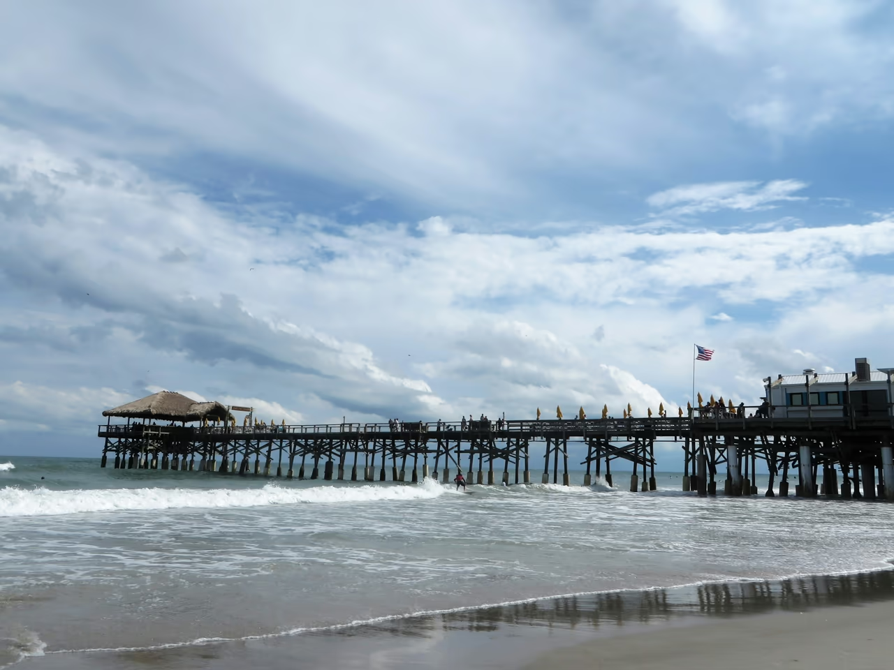
The pier has stood since 1962 and runs 800 feet (about 245 metres) into the Atlantic, with a busy stretch of sand beside it and surf breaks along the street ends. A ring dropped from the deck into the water is a diving question.
Jetty Park and Cherie Down Park, Cape Canaveral
Jetty Park sits at the Port Canaveral inlet, run by the Canaveral Port Authority, with a fishing pier and a beach facing the cruise ships. Just south, Cherie Down Park is a small county park with a boardwalk along the dunes, so most losses there are either on the boards or on the open sand below them.
Pelican Beach Park, Satellite Beach
At 1525 Highway A1A, with covered pavilions, volleyball and a playground, and Hightower Beach Park, the largest in the city, further north. A ring or earring lost on the dry sand here is usually a few centimetres down and still where it landed.
Indialantic Boardwalk and Paradise Beach Park
The boardwalk runs about five blocks at the east end of Fifth Avenue (US 192), with a surf break in front of it. A little north, Paradise Beach Park at 2301 N Highway A1A is a county park with dune crossovers, pavilions and seasonal lifeguards. An Oura ring or wedding band lost in the surf here is a low tide search, as it is at Cocoa Beach.
Melbourne Beach and Spessard Holland
Spessard Holland North and South Beach Parks on A1A are quiet county parks with boardwalks over the dunes and seasonal lifeguards. On the river side of town, the Melbourne Beach Pier reaches into the Indian River from Ryckman Park. A phone dropped off it into the river needs a different kind of search.
Sebastian Inlet State Park
About 10 miles (16 km) south of Melbourne Beach, with three miles of beach, two jetties reaching into the Atlantic and the First Peak surf break beside the north jetty. There are no lifeguards here, so the jetties are the only thing to measure from.
Playalinda Beach and the refuge beaches to the south
North of the Space Center, Playalinda Beach in Canaveral National Seashore has numbered parking areas, each with a boardwalk to the sand, so the lot number does the job a crossover name does in town. To the south, the Archie Carr National Wildlife Refuge takes in 20.5 miles (33 km) of beach from Melbourne Beach to Wabasso Beach, and the Barrier Island Center at 8385 S Highway A1A has a trail down to the beach.
What you get from Ring Seekers on the Space Coast
Always the same person
You explain it once, and the same person stays with you until the search is over.
Your map and photos reach the detectorist
Your crossover name, paces from the dune line, tide time and photos go to the person searching before they set off.
A straight answer on the odds
A ring that went past the sandbar days ago is not worth a drive, and we say so before anyone makes one.
A grid, not a wander
The work is a measured grid out from a fixed point, which is why the paces you counted matter more than the name of the town.
The cost comes before the booking
You are told what a search would come to while you are still deciding, and there is no surprise waiting at the end of it.
Sand, tide and water on the Space Coast
What decides whether a ring lost here can be found.
How deep a ring sits in this sand
On dry sand a ring normally sinks only a few centimetres, and further in wet sand. In 2019 a soldered engagement and wedding ring set lost at Cocoa Beach was found about a week later roughly 10 inches (25 cm) down after a four hour grid search. That is within reach of a beach detector.
Tides from Port Canaveral to Sebastian Inlet
NOAA gives a mean tide range of 3.4 feet (about 1 metre) at Trident Pier, Port Canaveral. Inside the inlet at the Sebastian Inlet station it drops to 2.11 feet (about 0.6 metres). There are two lows a day, and low water is when the wet strip can be walked.
Surf and water temperature
Off Cocoa Beach the sea is coldest in early to mid February, around 20 to 23 C (68 to 73 F), when cold fingers let rings slip. It peaks in late July at 28 to 30 C (82 to 86 F).
Ocean sand and river bottom
Everything from Cape Canaveral to Sebastian Inlet is Atlantic sand that drains at low water and can be walked with a detector. The Indian River side of Melbourne Beach is not, and what goes in off the pier settles into soft bottom that never uncovers.
Want a first idea of your chances? Try the lost ring recovery calculator.
Questions about the Space Coast
My class ring came off in the sand at a Cocoa Beach street end. How deep will it be?
Not as deep as you fear. On dry sand a ring sinks only a few centimetres, and a class ring is heavy and chunky, one of the loudest things a detector can be asked to find. In 2019 a soldered engagement and wedding ring set lost at Cocoa Beach turned up about a week later, roughly 10 inches (25 cm) down, after a four hour grid search. The hard part is not the depth, it is that Cocoa Beach has about 40 street end crossovers that all look alike from the sand.
I lost an earring at Lori Wilson Park, Paradise Beach Park or Spessard Holland. Where do I start?
With the crossover you walked over, because all three are laid out the same way: a car park, a boardwalk across the dunes, then open sand. An earring dropped on the boardwalk is a different job from one in the sand, so say which. Paradise Beach Park is at 2301 N Highway A1A and the Spessard Holland parks are further south on the same road.
My Oura ring came off at Satellite Beach or by the Indialantic Boardwalk. Is it worth a search?
Usually, if it went down on the sand rather than out in the surf. Satellite Beach has 17 street end crossovers, and Pelican Beach Park at 1525 Highway A1A has pavilions, volleyball and a playground, so people can normally name where they were. The Indialantic Boardwalk runs about five blocks at the east end of Fifth Avenue, which makes it easy to say how far along you had walked.
I lost my ring at Sebastian Inlet State Park. Can someone look for it?
It depends where. On the sand of its three miles of beach the odds are fair. Out in the moving water beside a jetty they are not, and you would hear that from us first.
My wedding ring came off in the surf. Is it gone?
Not always. These are sandbar beaches, and a ring lost waist deep tends to settle into the bar rather than travel far. The best chance is at low tide, when the wet strip can be walked. If you were out past the bar, or many tides have passed, we will say the odds are poor.
I dropped my phone off the Melbourne Beach Pier into the Indian River. What now?
That is a different kind of search from anything on the ocean side. The pier, built in 1889, reaches into the Indian River from Ryckman Park, so what went in is sitting in soft bottom rather than sand that drains at low tide. Tell us how far out you were and you will get a straight answer on whether it is reachable at all.
How much do you need to know before you can tell me anything?
Less than you think, to start. What was lost, roughly where and when is enough for a first answer. If a search looks realistic we then ask for the crossover or park name, your paces from the dune line, a map screenshot with the spot marked and a photo from where you sat. Not everything gets found, and you hear what a search would cost first.
Space Coast, Cocoa Beach and Melbourne Beach
One crossover in forty, and you know which
Cape Canaveral, Cocoa Beach, Satellite Beach, Indialantic, Melbourne Beach and Sebastian Inlet.
Write down the crossover or park name while you can still see the sign, count your paces from the dune line, and take a photo each way along the beach. Send it on WhatsApp with the hour and you will hear what a search can realistically do.