
Crystal Coast, Emerald Isle and New Bern
Lost a ring at Emerald Isle?
From the Point at Bogue Inlet to Fort Macon, and up the Neuse to Union Point Park.
An Oura ring reads on a detector much like a gold band, so one that came off in the shallows here is often still findable. What decides it is where it went down, dry sand, the wash, a sound-side dock or the river, and how well you can mark the spot before you leave the beach.
Ring Seekers is a lost ring and jewelry recovery service that works with experienced local metal detectorists to search for a ring, wedding band, watch or phone lost on the Crystal Coast of North Carolina. The search is done by an experienced local detectorist. We choose an experienced detectorist who knows Emerald Isle, Atlantic Beach, Beaufort or New Bern, brief them with your map and photos, and tell you honestly if the odds are poor.
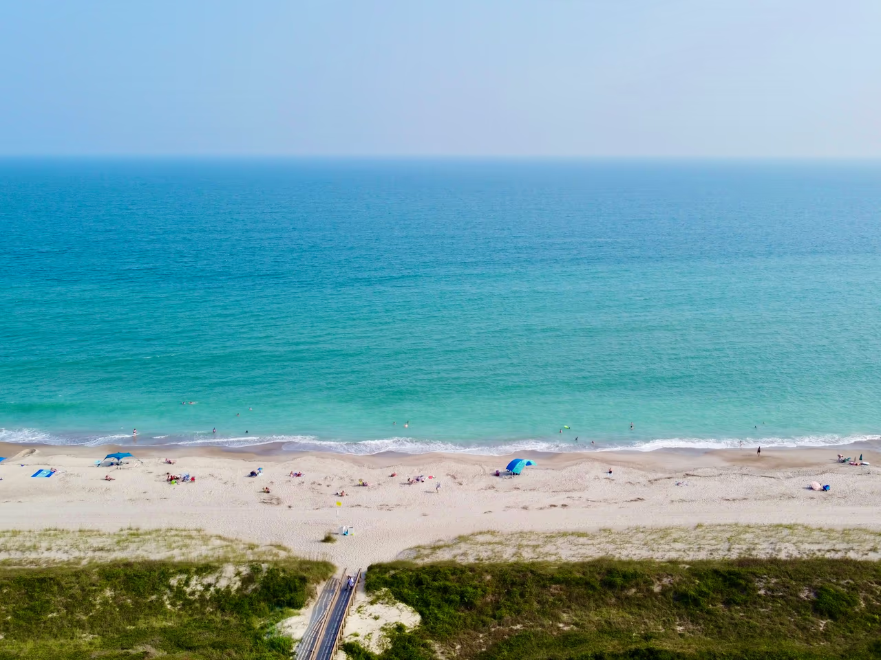
How a search works from Emerald Isle to New Bern
In the first hour, stop digging with your hands and keep people off the spot. Line it up with something fixed, such as a walkover or a pier piling, and take photos from two sides. Note the time, because the tide moves the waterline on the ocean beaches.
Send us the pin, the photos and what the item is, whether that is an Oura ring, a gold wedding band, a watch or a phone. We find a detectorist who can travel to that town, hand over everything you sent, and plan the search for the state of the tide that suits it.
Places we cover in Crystal Coast, Emerald Isle and New Bern
- Emerald Isle
- Bogue Inlet Pier
- The Point at Bogue Inlet
- Western Ocean Regional Access
- Eastern Ocean Regional Access
- Indian Beach
- Salter Path
- Pine Knoll Shores and the Iron Steamer access
- Atlantic Beach and the Circle
- Fort Macon State Park
- Shackleford Banks
- Cape Lookout Light Station beach
- Morehead City waterfront and Jaycee Park
- Beaufort waterfront on Taylor Creek
- New Bern
- Union Point Park on the Neuse River
- Bogue Sound docks and sound-side accesses
Crystal Coast beaches and waterfronts where jewelry goes missing
Bogue Inlet Pier, Emerald Isle
A family-owned fishing pier that reaches about 1,000 feet (300 metres) into the Atlantic. A ring slips off a wet finger while baiting a hook, and a phone or sunglasses can go over the rail. How far along the pier you were is the whole difference between a search and a shrug.
The Point and Western Ocean Regional Access
The Point is the western tip of Emerald Isle where the beach meets Bogue Inlet. It is a favourite with anglers and beachcombers, but currents through the inlet run strong, so a ring dropped in the water there is hard to reach. The Western Ocean Regional Access, off Islander Drive, has lifeguards, volleyball courts and a picnic pavilion.
Indian Beach and Salter Path
The middle of Bogue Banks, between Emerald Isle and Pine Knoll Shores. The Salter Path Regional Access sits within the Roosevelt State Park area, and the Indian Beach access has a four-wheel drive ramp down to the sand. Cars and gear come and go there all day, so mark a lost ring against a fixed access sign rather than against a towel.
Pine Knoll Shores and the Iron Steamer access
The Iron Steamer regional access, near milepost 7.5, sits just west of the site of the former Iron Steamer fishing pier. It is quieter sand than the Circle or the Point, which helps, and the milepost gives a searcher a number to work from instead of a stretch of dune that looks the same for a mile.
Atlantic Beach, the Circle and Fort Macon
The Circle is the main public access straight down from the bridge, busy with families and umbrellas all summer. Fort Macon takes up the eastern 1.4 miles of Bogue Banks, with a swim beach and accesses on both the ocean and the inlet, so which of the two you were on changes the search.
Shackleford Banks and Cape Lookout
Across Beaufort Inlet from Fort Macon, Shackleford Banks is about 8 miles of beach with wild horses, reached only by boat, with passenger ferries from Beaufort to its west end and from Harkers Island to its east end. Further along, ferries from the Harkers Island Visitor Center land at the Cape Lookout Light Station, and a beach shuttle runs on towards the point. Tell us where the boat dropped you and which way you walked.
Beaufort and Morehead City waterfronts
Beaufort has a wide boardwalk beside Front Street along Taylor Creek, with boats docked just yards away. The Morehead City boardwalk edges Bogue Sound past boat slips, and Jaycee Park has small piers at 8th and 9th Streets. An earring, a ring, keys or a phone can drop between boards or off the edge when stepping on and off a boat.
Union Point Park, New Bern
A park at the point where the Trent River meets the Neuse in downtown New Bern, with a fishing pier, two boat launches and a walkway to Bicentennial Park. A ring lost on the lawn is a far easier job than one dropped off the pier into the river.
What you get when you message Ring Seekers
One person on WhatsApp
You explain it once. The same person takes the details, chooses an experienced detectorist who knows your spot and keeps you posted.
Your map and photos go to the detectorist
We brief whoever can reach Emerald Isle, Atlantic Beach, Beaufort or New Bern with your pin and photos, so they start in the right place.
Plain about poor odds
A phone off the end of Bogue Inlet Pier, or a ring lost in the current at the Point, may not be worth the trip. If that is the case we say so before anything is booked.
We work the ocean beaches at low water
On Bogue Banks the searchable strip opens and closes with the tide. Up the Neuse at New Bern there is barely any tide at all, so the timing there is yours rather than the water.
The cost comes before the decision
You know what a search would come to while you are still weighing it up, not after somebody has crossed the bridge.
Sand, tides and water on the Crystal Coast
Tides
The mean tide range is 3.65 feet (about 1.1 metres) at the Atlantic Beach station and 3.11 feet (about 95 cm) at the Duke Marine Lab in Beaufort, on NOAA figures. Up the Neuse at Oriental the mean range is only about half a foot (15 cm), and at New Bern the river has almost no tide. On the ocean beaches, a ring lost in the wash is best searched at low water.
Surf and currents
Currents through Bogue Inlet at the Point run hard, which is why a ring lost in the water there is a much harder job than one lost on the dry sand fifty yards back. Along the rest of the island a wading search is timed for a calm day near low water, when the strip that matters is uncovered and the sand is firm underfoot.
Water temperature
Water at the Duke Marine Lab in Beaufort read between about 82 and 88 F (28 to 31 C) in August 2026, and between about 33 and 54 F (0 to 12 C) in February 2026. Cold water shrinks fingers, which is how a loose band goes in the first place.
Accesses, mileposts and walkovers
This island is read off its entrances: the Western and Eastern Ocean Regional Accesses at Emerald Isle, the Iron Steamer access near milepost 7.5 at Pine Knoll Shores, the Circle at Atlantic Beach. Naming the one you walked through, and which way you turned at the top of the walkover, turns a long barrier island into a strip one person can cover.
Want a first idea of your chances? Try the lost ring recovery calculator.
Questions about Crystal Coast, Emerald Isle and New Bern
My Oura ring came off in the water at Emerald Isle. Can a detector find it?
Often it can. An Oura ring carries enough metal to read clearly, much like a gold band. The wash is the hard part, because it moves a small ring along and buries it, which is why a search there is worked at low water. Tell us how deep you were standing and which walkover you came down.
I lost my wedding band near Bogue Inlet Pier. What should I note?
Which side of the pier you were on, how far out along it, and the time. The pier reaches about 1,000 feet (300 metres) into the Atlantic, so a band dropped near the beach end is a far better case than a phone or sunglasses dropped off the far end into deeper water.
Is a ring lost at the Point in Emerald Isle worth searching for?
On the dry sand, often yes. In the water it is harder, because the currents through Bogue Inlet run strong there. Do not go back in to look. Mark where you were sitting, note the state of the tide, and send us a photo looking both ways along the beach.
My ring is somewhere on the beach at Fort Macon. Where do we start?
With which water you were facing. Fort Macon takes up the eastern 1.4 miles of Bogue Banks and has a swim beach plus accesses on both the ocean and the inlet, and the two sides behave differently. Tell us which side, which car park you used and how far you walked from the bathhouse.
I dropped an earring or my Oura ring off a dock in Beaufort or Morehead City. Can it be found?
Sometimes. It comes down to depth, because a detector cannot reach the bottom in deep water from a dock, and past a certain point it becomes a diver job instead. Tell us which slip or which set of steps, and how far the water was below you when it went.
What about a ring or bracelet lost at Union Point Park in New Bern?
On the grass that is a good search. Union Point is six acres where the Trent meets the Neuse, with a gazebo used for weddings, and a bracelet that comes off there stays where it fell. The Neuse at New Bern has almost no tide, and the water moves mostly with the wind, so the river edge is not reshaped twice a day.
What should I send you first?
A pin on a map, a few photos of the spot with something fixed in shot, such as a walkover, a pier piling, a lifeguard stand or an access sign, the hour it happened, and what the item is made of. You will have the cost of a search in front of you before anything is arranged.
Crystal Coast, Emerald Isle and New Bern
Which access you walked through, and at what hour
The ocean beaches are remade by every tide. The Neuse at New Bern barely moves. Send those two answers on WhatsApp with a pin and a couple of photos, and we will tell you which of them you are up against.