
Panama City Beach
Lost a ring at Panama City Beach?
St. Andrews Bay, the marina docks, two long Gulf piers and the sand from Laguna Beach out to Shell Island.
The worst part of losing something off a boat is that the one landmark you had was floating. Tied up at a dock the water underneath stays put and there is a patch to work on. Out on the bay it comes down to what you noted before the boat drifted, so the plotter mark and the time matter more than anything described later. On sand it is a different job, and usually a better one.
Ring Seekers is a lost ring and jewelry recovery service that works with experienced local metal detectorists to search for a ring, wedding band, watch or phone lost in Panama City Beach. We are a small service that chooses the right local detectorist for each search. Tell us what happened and where. We choose an experienced detectorist who knows the beach, brief them with your map and photos, and tell you honestly if the odds are poor.
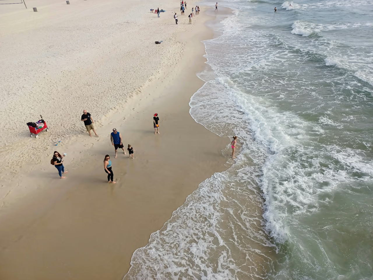
On the water, mark it before the boat moves
If it went over the side, drop a mark on the plotter or a pin on your phone straight away and write down the time, because a boat carries on moving while everybody is still looking at the water. Note the depth if the sounder shows it, and whether you were made fast or lying at anchor.
On sand the first hour is the same idea. Stand where you were sitting, take a photo with a pier, a lifeguard tower or the numbered access sign in the frame, and drop a pin. Then send the pin, the photos, the hour and what was lost.
Places we cover in Panama City Beach
- Panama City Beach
- Russell-Fields Pier and City Beach
- Pier Park and Front Beach Road
- M.B. Miller County Pier
- Rick Seltzer Park, Thomas Drive
- St. Andrews State Park
- Shell Island
- Grand Lagoon
- Laguna Beach
- Panama City
- St. Andrews Bay and St. Andrews Marina
- Mexico Beach
- Beachfront rentals and resorts
Piers, parks and beaches around St. Andrews Bay
Long Gulf piers, a busy strip of beach, a barrier island reached by boat and the bay side of Panama City.
Russell-Fields Pier and Pier Park
Russell-Fields Pier runs over 1,500 feet (more than 457 metres) out from directly across the main entrance to Pier Park on Front Beach Road. It is the landmark most people on this stretch can place themselves against, and a ring or watch that comes off in the surf beside it is workable sand.
M.B. Miller County Pier, Front Beach Road
The second of the two long piers, sitting 1,500 feet out into the Gulf and open around the clock, with surf rescue working from here and from Rick Seltzer Park on Thomas Drive. Anything over the rail near the far end is in open water; near the beach end it is a different prospect.
St. Andrews State Park
At the east end of Thomas Drive, with rocky jetties on the Gulf side and a fishing pier on the Grand Lagoon. The jetties are where people snorkel and climb about, and where a band comes off a wet hand. Between the rocks a detector still hears it, but lifting it out is slow work.
Shell Island
An undeveloped barrier island almost 7 miles (about 11 km) long, seen from the jetties across the St. Andrews shipping channel. It is reached by the shuttle or by private boat and everything is carried in, so the sand stays far less disturbed than the mainland strip. Where the boat beached is the fixed point a search is built from.
Laguna Beach
A community at the west end, named after the coastal dune lakes of this part of northwest Florida. The beach is reached by numbered public walkovers, so the access number is the quickest way to place yourself on a shoreline that looks the same for miles.
Panama City and St. Andrews Bay
Across the bay, St. Andrews Marina sits in the historic St. Andrews district of Panama City, off the Intracoastal Waterway. A phone, keys or sunglasses dropped from a dock or a boat here go straight into the bay. A slip or a dock is a fixed patch to work on; open water with a drifting boat is the hard end of this page.
Mexico Beach
A quieter beach town a straightforward drive further east, laid out street by street down to the water, so the street you walked down is what places you there.
How Ring Seekers helps around Panama City Beach
One person on WhatsApp
You explain the loss once, and the same person finds a detectorist and stays your contact throughout.
Your map and photos go to the detectorist
The detectorist starts from your pin and photos rather than from a description passed down a chain.
Plain about poor odds
Open water off the end of a pier, or a drifting boat on the bay, is hard ground, and you hear that from us before anything is arranged.
Water and sand are two different searches
A dock, a jetty and dry sand each get their own plan, and you are told which one yours is before anyone sets off.
The figure is agreed in writing first
What a search would come to is settled before a searcher is booked, so there is nothing to work out afterwards.
A one foot tide on a hard rip current coast
A small Gulf tide, strong rip currents, warm water for most of the year and two long piers to measure from.
A small Gulf tide
NOAA puts the mean tide range at its Panama City Beach station at 1.25 feet (about 38 cm), and 1.39 feet (about 42 cm) between the higher high and lower low. The bay station at Panama City has the same mean range.
Rip currents
Rip currents are the serious hazard on this coast: CBS News reported that seven people died at Panama City Beach over nine days in June 2023. Never go back into rough water to look, and a search of the wet strip is timed for a calm day and low water rather than the first free afternoon.
Water temperature
NOAA coastal water temperature averages for Panama City Beach run from 59.5°F (about 15°C) in January to 85.6°F (about 30°C) in August. Cold water makes fingers shrink, and a ring can then slip off more easily.
Piers, towers and numbered walkovers
Nothing here helps a searcher like something that does not move. Russell-Fields Pier and M.B. Miller County Pier stand 1,500 feet out into the Gulf and are visible a long way along the sand, the lifeguard towers give a second line, and the Laguna Beach walkovers are numbered. One of those in a photograph turns a described beach into a measured one.
Want a first idea of your chances? Try the lost ring recovery calculator.
Off a boat, off a pier, or down in the sand
My ring went over the side of the boat in St. Andrews Bay. Is there anything to be done?
It depends entirely on where the boat was. Tied up at a dock or a slip at St. Andrews Marina, the water underneath is a fixed patch and a searcher has something to work with. Out on the open bay, with the boat drifting while you looked, that is a long shot, and you would hear that from us first. Mark the spot on the plotter and note the time before you move.
We took a boat over to Shell Island and my engagement ring is somewhere on that sand. Now what?
Work out where you landed. Shell Island is an undeveloped barrier island almost 7 miles (about 11 km) long with nothing built on it, so the landing point is the only fixed thing you have. Whether you came on the shuttle or your own boat, mark where it beached, then say how far along you walked and whether you were on dry sand or down by the water.
I lost my ring on the beach by Russell-Fields Pier. How do I show you the spot?
Use the pier. It runs more than 1,500 feet (457 metres) out from directly opposite the main entrance to Pier Park, so a photo with it in frame tells a searcher how far along the sand you were and which side of it. Add a pin, say how far down towards the water you had walked, and give us the hour so the tide can be worked out.
My phone went over the rail of M.B. Miller County Pier. Is it worth a search?
Sometimes, and the part of the pier decides it. That pier also reaches about 1,500 feet into the Gulf, so anything dropped near the far end lands in open water. A phone and metal-framed glasses hold enough metal to read, so close in to the beach they are workable. Tell us how far out along the boards you had walked.
My wedding band came off at St. Andrews State Park. Where would a search start?
At the jetties, if that is where you were. The park sits at the east end of Thomas Drive with rocky jetties and a fishing pier on the Grand Lagoon, and those are the landmarks to photograph. Say whether you were on sand, on the rocks or in the water beside them, because a band that slides between rocks reads clearly but takes far longer to lift out.
My Oura ring came off in the surf at Laguna Beach. Can it be found?
Often, if it went in near the shore and you can point to the spot. An Oura ring has a metal shell, so a detector reads it much as it reads a band. Laguna Beach is reached by numbered public walkovers, so the number of the one you used is the quickest way to place yourself on a stretch of coast that otherwise looks identical for miles.
I lost a bracelet at Mexico Beach. Is that far enough out to be a problem?
No, it is a straightforward drive east and a quieter beach than the strip. A bracelet or a chain lands flat and tends to stay near the surface in dry sand, which is in your favour. Tell us which street you came down to the water on and roughly how far along you had walked before you noticed.
I lost my ring a few days ago and I have already flown home. Is it too late?
Not always. Waves and footprints move sand every day, but a ring does not simply vanish. Send your photos and a pin, however rough, and you will get an honest view of whether a search still makes sense.
Panama City Beach
A mark on the water, or a pier in the photo
Whichever of the two you have, it is the fixed point everything else is built on.
Send it on WhatsApp with the hour and what was lost, and say whether the boat was made fast or drifting. You will get a straight view of the chances and, if it is worth doing, a searcher who can reach that water or that sand.