
Pismo Beach, Morro Bay and the Central Coast
Lost a wedding ring at Pismo Beach?
Clifftop wedding lawns, the city beach and pier, the dunes at Oceano and the sand by Morro Rock
Grass is the kindest ground a wedding band can land on. It drops through and sits in the thatch near the surface, a step or two from where it came off, which is why the lawns at Dinosaur Caves Park and Margo Dodd Park in Shell Beach beat open sand. What matters most is that nobody mows the patch.
Ring Seekers is a lost ring and jewelry recovery service that works with experienced local metal detectorists to search for a ring, wedding band, watch or phone lost in Pismo Beach, Shell Beach, Grover Beach, Oceano, Avila Beach or Morro Bay, on the Central Coast of California. We choose an experienced detectorist who knows your spot and brief them with your map and photos.
Before the mower, or the next tide
Go back and pick a marker that will still be there next week: the gazebo at Margo Dodd Park, the amphitheatre at Dinosaur Caves, Pismo Beach Pier, a post at Oceano Dunes, Harford Pier or Morro Rock. Photograph the spot with that marker in frame and save a pin. Do not comb the grass or scrape the sand with your fingers.
Then message us with the park or beach, the patch within it, the time and a photo of the band. On a lawn, say whether it has been mown and where the clippings went.
Places we cover in Pismo Beach, Morro Bay and the Central Coast
- Pismo Beach
- Pismo Beach city beach and Pismo Beach Pier
- Pismo Creek mouth at Addie Street
- Shell Beach
- Dinosaur Caves Park
- Margo Dodd Park, Shell Beach
- Grover Beach and the West Grand Avenue beach entrance
- Pismo State Beach
- Pismo State Beach Monarch Butterfly Grove
- Oceano and the Pier Avenue entrance
- Oceano Dunes State Vehicular Recreation Area
- Avila Beach
- Avila Pier
- Olde Port Beach
- Fisherman's Beach and Harford Pier
- Morro Bay
- Morro Rock and the Morro Bay City Beach
- Coleman Beach
- The Sandspit
- Morro Strand State Beach
- Morro Bay State Park and Windy Cove
Beaches, piers and bluff parks from Oceano to Morro Strand
Each place behaves differently, and that changes what a detectorist can do.
Pismo Beach city beach and pier
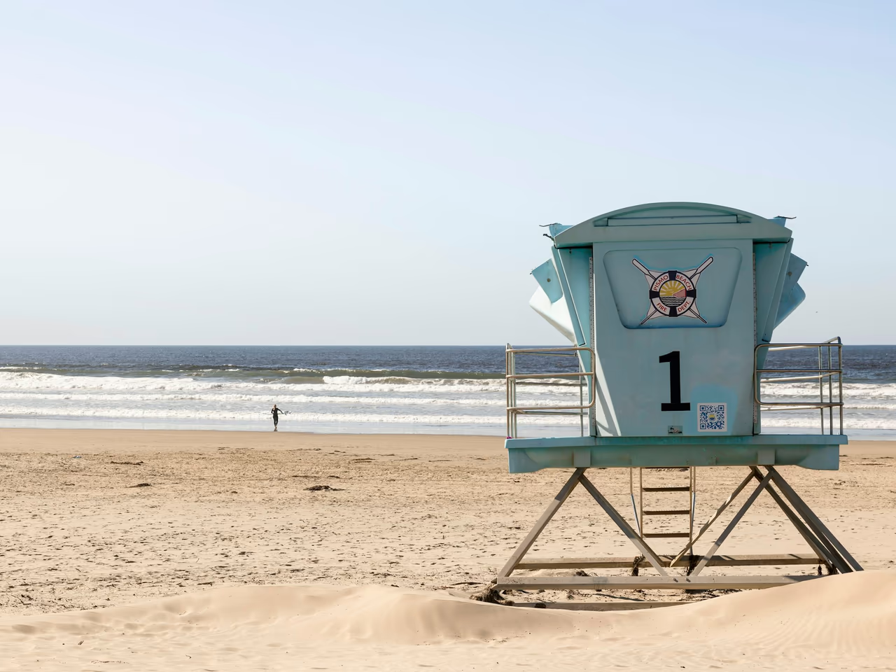
A 60 acre regional beach, pier and promenade with volleyball courts, sand showers and play equipment, where lifeguards cover about 1.5 miles of sand from five towers between Memorial Day and Labor Day weekends. Those towers are the simplest way to place yourself. Pismo Creek meets the ocean at the end of Addie Street.
Dinosaur Caves Park and Margo Dodd Park, Shell Beach
An 11 acre bluff top park at Cliff Street and Shell Beach Road, with a wedding site above the ocean, a grassy reception area, an amphitheatre and a playground. Margo Dodd Park next door has a covered gazebo used for weddings, and beach access at the end of Pier Street.
Grover Beach, Oceano and Oceano Dunes
Pismo State Beach runs in front of Grover Beach and Oceano. Vehicles come onto the sand at the end of West Grand Avenue and at Pier Avenue, and Post 2, one mile south of Pier Avenue, marks the start of the off highway vehicle area. Arroyo Grande Creek can cut across the route south, and a numbered post or your campsite is what to write down.
Avila Beach, Olde Port Beach and Harford Pier
The most popular beach in San Luis Obispo County, with the 1,630 foot Avila Pier, restrooms and lifeguards looked after by the Port San Luis Harbor District. Along the shore are Olde Port Beach, used for launching small craft, and Fisherman's Beach. Harford Pier, 1,424 feet of national historic structure, is where phones and keys go in.
Morro Rock, the City Beach and Coleman Beach
Morro Rock stands 576 feet (176 metres) at the mouth of the harbour and is a State Historic Landmark, so everybody can point to it. The City Beach runs north of the rock, the Sandspit lies south of it, and Coleman Beach and South Beach sit inside the harbour, in calmer water. The far end of the Sandspit runs into Montaña de Oro State Park.
Morro Strand State Beach
A three mile (about 5 km) state beach north of the harbour, used for swimming, surfing, windsurfing and fishing, with over 70 campsites. The water is cooler here than in Southern California, so surfers wear wetsuits, and a cold hand is how many rings come off.
Morro Bay State Park and the estuary
The park sits on the estuary, with saltwater and brackish marshes, a marina, boat ramps and kayaking, and the Museum of Natural History above Windy Cove. Marsh is soft, slow ground, so what matters is where you launched and how deep it was.
What you get when you message us about the Central Coast
One person on WhatsApp
One person takes your first message, finds the searcher and stays with it to the end.
Your map and photos go to the detectorist
The pin, the photos and your marker, a tower at Pismo or a post at Oceano, reach the detectorist before they set off.
Lawns and surf are not the same search
On a clifftop lawn the coil moves slowly over a small square and the band sits shallow. In the surf the machine, the depth and the tide all change.
Plain about poor odds
A watch that went into the surf at Morro Strand days ago is a poor case, and you hear that before anyone drives out.
The cost comes before the decision
You are told what a search would cost while you are still weighing it up, and nothing is arranged until you say yes.
Tide, water and ground from Pismo Beach to Morro Bay
The facts a detectorist works with on this stretch of coast.
Tides at Port San Luis
The nearest long term NOAA tide station is Port San Luis (9412110), near Avila Beach. There the mean tide range is 1.09 metres (3.58 feet), and the great diurnal range, from the average higher high tide to the average lower low, is 1.62 metres (5.32 feet). Wet sand and shallow water are worked at the lower of the two daily low tides.
Surf, currents and creeks
Rip and lateral currents develop on the city beach, and lifeguards warn they are dangerous for inexperienced swimmers. Farther south, Arroyo Grande Creek rises with releases from Lopez Dam and winter storms and can cut off the vehicle area at Oceano Dunes.
Water temperature
Long term averages for Pismo Beach put the sea at about 12.3 C (54 F) in April and about 14.9 C (59 F) in August, so it stays cool all year. Cold fingers shrink and rings slip off, which is half the reason people end up searching metal detecting California beaches this far north.
Clifftop grass, beach sand and dune sand
The lawns at Dinosaur Caves and Margo Dodd hold a band in the thatch, so the search is slow and close over a small square. City beach sand takes it deeper. Dune sand at Oceano moves with the wind and with vehicles, which is why a post or a campsite matters most there.
Harbour water and open coast
Inside the harbour the water is calm and an item stays put. Out at Morro Strand and off the Pismo sand the surf keeps working, so anything in it moves, which is why those searches cannot wait.
Want a first idea of your chances? Try the lost ring recovery calculator.
Questions about Pismo Beach, Morro Bay and the Central Coast
A wedding band went missing on the lawn at Dinosaur Caves Park. What now?
Keep everyone off the grass and work out where the day actually happened. The park has a wedding site above the ocean, a grassy reception area, an amphitheatre and a playground, so two or three marked patches beat the whole 11 acres. Grass holds a band near the surface, which makes it far better ground than sand. The gazebo lawn at Margo Dodd Park works the same way.
My Oura ring came off in the surf near Pismo Beach Pier. Can a detector find it?
It can, because an Oura ring and a watch both hold enough metal for a water machine to read. Place yourself between the pier and the nearest of the five lifeguard towers, and say how deep you were standing. Lifeguards here warn about rip and lateral currents, so the sooner someone looks, and the closer to low tide, the better.
I dropped my phone off Harford Pier at Avila Beach. Is it worth trying?
It can be. Harford Pier is a 1,424 foot fishing pier, so note how far out you were and which side, using a building or a bench as your marker. Depth, swell and visibility decide it, and under a working pier it is a harder search than open sand.
I lost my ring while camping on the sand at Oceano Dunes. Where do I start?
Write down your campsite or the nearest numbered post. Post 2 sits one mile (1.6 km) south of the Pier Avenue entrance in Oceano and marks the start of the vehicle area, which gives a searcher a line to measure from. Say whether it went down in a vehicle track or soft sand: a track is packed hard and holds an item shallow.
I lost an earring on the beach by Morro Rock. Which beach do you need?
The exact one, because three run together there. The City Beach is north of the rock, the Sandspit south of it, and Coleman Beach inside the harbour by Coleman Park. In summer the Harbor Department staffs lifeguard towers on the City Beach, and a tower is the easiest marker to give us. An earring reads faintly, so the tighter the patch the better.
My car keys went overboard while kayaking in Morro Bay. Any chance?
The keys, possibly. Metal sunglass frames give a signal too, while plastic ones are found by eye or not at all. The bay is part marsh and part sand, so tell us where you launched, where you tipped and how deep it was. Over soft mud in deep water it is a long shot, and you would hear that from us first.
What happens if nothing turns up?
Some rings are not found, and you hear that from the same person who took your first message. Before anyone travels you get our view of the case and what it would cost. If a search comes up empty, we say so plainly.
Pismo Beach, Morro Bay and the Central Coast
Mark the lawn, or the sand, before you leave it
The park or beach, the patch within it, and a photo with a fixed marker.
Grass keeps a band where it fell until somebody mows. Sand does not wait that long, and vehicles cross it at Grover Beach and Oceano. Photograph it and drop the pin while you are standing there, then send us both.